
Parts of Long Island vulnerable to extreme heat
Even though New York State and Long Island are not facing the severe heat currently scorching the west coast, New York is still at risk of excessive heat.
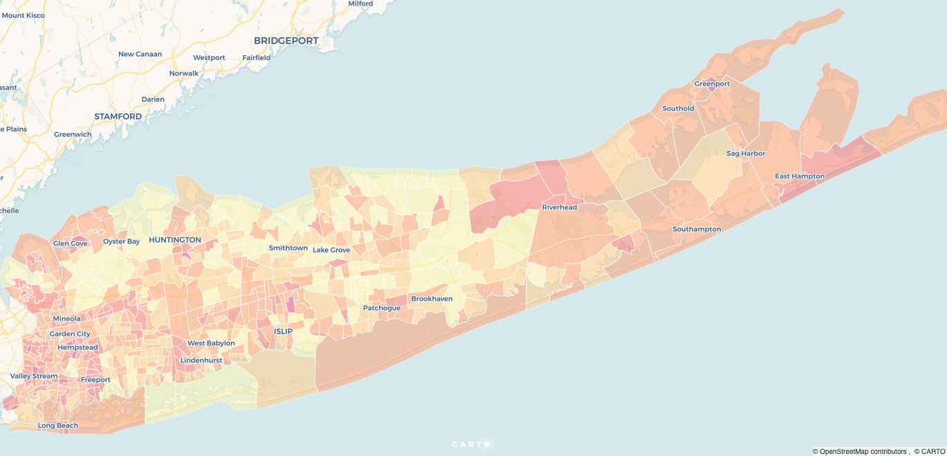
To understand how excessive heat might affect different parts of Long Island, let’s turn to the heat vulnerability index.
The index was developed to help identify population areas that are vulnerable to extreme heat, and to assist local agencies with prioritizing preventative measures to protect vulnerable communities.
But heat affects different people and different areas differently – some communities are at risk because of elderly isolation, others may be at risk due to urban development or environmental factors, and others may be more vulnerable because of socio-economic circumstances or language barriers.
We’ve overlaid the overall heat vulnerability score on a map below and the different categories as well. Take a look at the map and our guide on how to read it.
(Hover or click on the map for more information)
How to read the map
These are the categories created by New York State to index/score vulnerability
Language vulnerability
Language can be a barrier to understanding alert messages or accessing resources, and the vulnerability score here takes into account:
- Percentage of population who is Hispanic
- Percent of population who is foreign born
- Percent of population who speak English “less than very well”
Socio-economic vulnerability
Socio-economic status can affect both the individual and community in terms of access to resources. This variable takes into account:
- Percentage of population with income below poverty level
- Percentage of population who is Black
- Percentage of population (18-64) who has a disability
- Percentage of population (18-64) who are unemployed
Environmental/urban vulnerability
Density, materials used in buildings, roads and pavements, green space – all of these things affect how heat is retained in an area.
- Percentage of houses built before 1980
- Density of housing per square mile
- Percentage of land with highly developed areas
- Percentage of land that consists of open underdeveloped areas
Elderly isolation and vulnerability
Elderly isolation can exacerbate and affect their access to timely assistance, particularly if they’re living away from family or the majority of community.
- Percentage of population 65 years of age and over
- Percentage of population 65 years of age and over and living alone